Questions to be solved?
- How to view local photos on Google Earth?
- How to display local images as geotagged placemarks on Google Earth?
- How to put geotagged pictures on Google Earth?
- How to view local images from Google Earth at the place where images were taken?
- Displaying geotagged photos on Google Earth?
- How to convert geotagged pictures to KMZ/KML files?
- How to show local images as overlays on Google Earth?
- KMZ file show images as place marks?
- Images embedded in kms files show up in Google Earth?
- Converting Geotagged photos to KML photo overlays on Google Earth?
- Have geotagging photos displayed on Maps?
- Creating place marks from geotagged photos?
Solutions
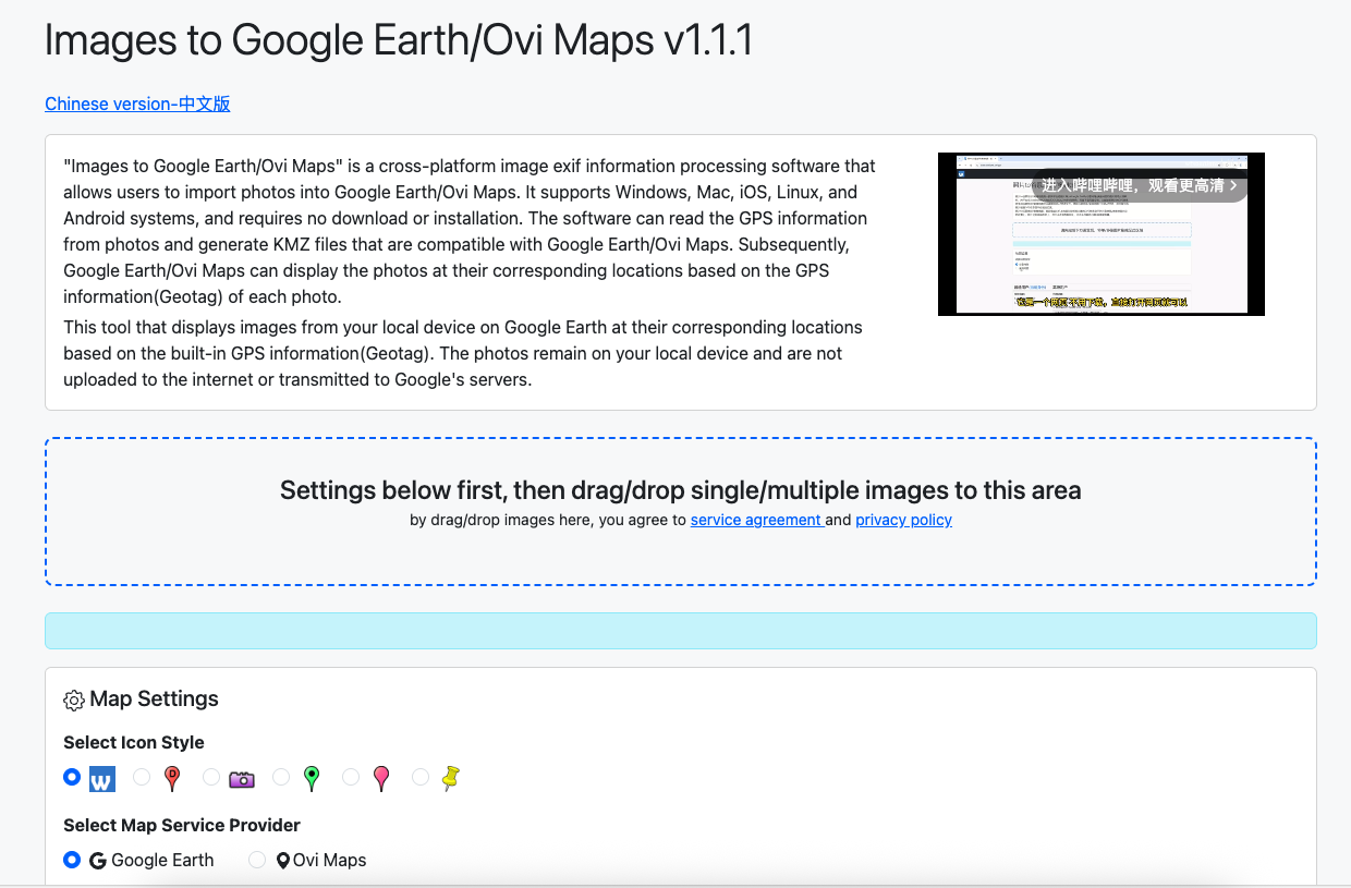
If you have one of the above questions, you can use the Images to Google Earth/Ovi Maps tool to solve it at s.wtsolutions.cn/gpsen.html
Sanpshot

Images to Google Earth/Ovi Maps
Images to Google Earth/Ovi Maps is a tool that allows you to display local geotagged images on Google Earth as one place mark overlay at corresponding GPS locations. All images stays on your local device, and will not be uploaded to Google Earth server, therefore only you and those who have your kmz files can view them.
How it works
- Users Drag one photo or serveral photos to the dotted area on the website;
- This tool will analyse the EXIF data of the photo and extract the GPS information;
- This tool write the GPS information to the KMZ file, within the KMZ file, all images will be instructed to be displayed as one place mark overlay at corresponding GPS locations;
- Users download KMZ file, and open it with Google Earth or Ovi Maps (Kmz file and images are all in the same folder on your local device);
- From Google Earth/Ovi Maps, users can view all images as one place mark overlay at corresponding GPS locations;
- Users click on one of the place mark icons, a overlay window will be displayed, and the image will be displayed in the overlay window;
- In the window, users can view Filename, Latitude, Longitude, Altitude, and the photo displayed;
Extracting GPS data and export to CSV file
- After users drag photos to the dotted area, they can click the "Export to CSV File" button in the "Pro Users" area;
- This tool will extract the GPS information from the EXIF data of the photos, and write the GPS information to the CSV file;
- Users can download the CSV file, and open it with spreadsheet software such as Excel and Numbers;
- In the CSV file, users can view Filename, Latitude, Longitude, Altitude;
Applicable Scenarios
- Geotag Analysis: Analyze the geographical distribution patterns of a large number of photos to study popular shooting areas.
- Travel Route Recording: Record travel routes and stopover points to generate detailed travel reports.
- Scientific Research Data Collection: Used in scientific research activities such as ecological surveys and geological investigations to establish georeferenced databases.
- Commercial Applications: Industries such as real estate and tourist attractions that need to display geographical location information can create location visualization reports.
- Law Enforcement Evidence Collection: Law enforcement officers can record the geographical location evidence of photos taken at crime scenes.
- Insurance Investigation: Record the geographical location information of accident scenes during insurance claims.
Technical Features
- Batch Processing: Supports exporting GPS data from hundreds of photos at once.
- Complete Data: Extracts all available EXIF GPS information.
- Format Compatibility: The generated CSV file is compatible with mainstream data analysis software.
- High - Performance Processing: Processed by local hardware.
- Privacy Protection: All processing is done locally in the browser, and photo data is not uploaded to the server.