关注公众号"seeling_GIS",领取学习视频资料
服务发布 请看之前发布的文章
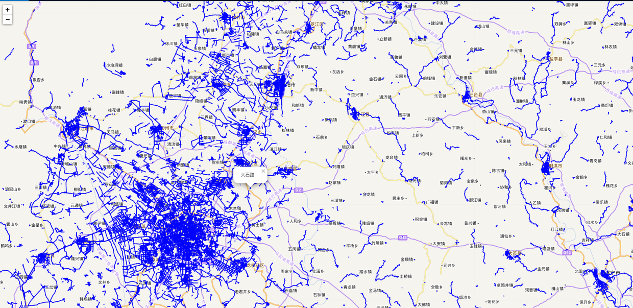
实现效果
相关数据和插件
- leaflet 需要使用插件 L.vectorGrid
- api 文档 github.com/Leaflet/Lea…
- 网盘地址 链接: pan.baidu.com/s/1H46XCK3P… 密码:ywo3
说明
-
地图投影和调用的服务投影需要保持一致,这里使用的是 3857,服务对应的是 90013
-
在这渲染方式上是以图层的方式 sc_countryroad 图层,因为就这一个图层,地图加载的是天地图为什么要加载天地图呢
-
需要注意的是当你选择以 tms 服务时, tms: true,该属性要设为 true,interactive 是开启图层事件的属性。
代码实现 使用 vue@leaflet 的方式开发
// 引入 插件
import '@/assets/Leaflet/Leaflet.VectorGrid.bundled.min.js';
import '@/assets/Leaflet/Leaflet.VectorGrid.min.js';

// pbf 服务
var url = `http://ip:port/geoserver/gwc/service/tms/1.0.0/geotest:sc_countryroad@EPSG:900913@pbf/\{z\}/\{x\}/\{-y\}.pbf`;

 var vectorTileOptions = {
        layerURL: url,
        rendererFactory: L.canvas.tile,
        tms: true,
        vectorTileLayerStyles: {
           sc_countryroad: function(properties, zoom) {
                var prop = parseInt(properties.KIND);
                //do something
            }
        },
        interactive: true, //开启VectorGrid触发mouse/pointer事件
        getFeatureId: function(f) {
          return f.properties.osm_id;
        }

         var vectorTile = new L.vectorGrid.protobuf(url, vectorTileOptions).addTo(
        this._map
      );
        vectorTile.on("mouseover", e => {
        var properties = e.layer.properties;
        L.popup()
          .setContent(properties.NAME)
          .setLatLng(e.latlng)
          .openOn(this._map);
      });
更多内容,欢迎关注公众号